Real People. Real Conflict. Real Romance.
Historical Romance
in the style of Jane Austen

Travel Maps
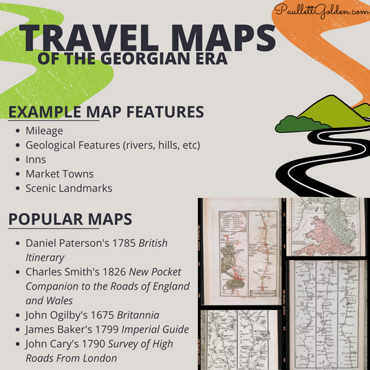
Examples of the road maps available in the Georgian era
Our Georgian era travellers had a few different types of maps at their disposal for their travelling needs.
The maps looked nothing remotely like what we're accustomed to today, but there were maps available for travellers. Which map you wanted depended on the purpose, destination, and type of travel, as each map offered something different and unique, such as a map of the terrain vs a map of the market towns and most direct roads vs a map of the scenic areas and best food, etc.
For those wishing for direct travel routes, such as a coachman, Paterson's British Itinerary would be a great choice, as it showed the best roads with important features marked (hills, rivers, towns/villages, estate boundaries, market towns, miles travelled, etc.).
For those wanting a scenic day out, Baker's Imperial Guide would be best, as it included a pictorial and illustrated map of sites such as scenic vistas, windmills, churches, inns with good food, manors open to tourists, landmarks, etc.
There were a few towns that had their own travel maps for the immediate area, typically available at the inns, and often with a list (or complete guidebook) of the best nearby estates/manors to tour (and yes, you read this last part correctly! Just about every stately home was open for tours via the housekeeper or butler, although usually only when the master was not in residence. There are some great books on this, such as Jocelyn Anderson's Touring and Publicizing England's Country Homes in the Eighteenth Century and Adrian Tinniswood's The Polite Tourist: Four Centuries of Country House Visiting.) Once entering a village for the first time, it was beneficial to ask about such maps/guidebooks at whatever inn was available, as these guides were quite popular and would help acquaint the newcomer to the area.
With the surge in Turnpikes during the 18th century, travel times were reduced from days to hours. Longer journeys were reduced considerably, such as London to Edinburgh taking from 256 hours in the 17th century to only 60 hours by 1800, or London to Exeter reduced from 240 hours to 32 hours.
To read more about the maps mentioned here and in the graphic, as well as to see samples and even download copies of a few of the types, check out this post from the British Library:
The British Library: The Natural World Through Early Modern Strip Maps
